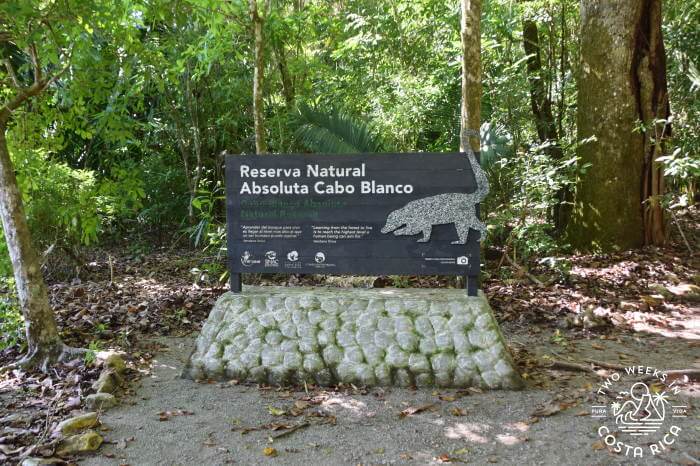
Cabo Blanco Nature Reserve (Reserva Natural Absoluta Cabo Blanco), located just south of Montezuma, is a special place. It was Costa Rica’s first nature reserve, created back in 1963. In that regard, Cabo Blanco epitomizes the country’s commitment to conservation.
Cabo Blanco offers a challenging hike through thick tropical forest. A gorgeous beach at the end of the trail is the reward for a long day of trekking. This park is a must-see for those venturing to the remote southern Nicoya Peninsula. Below are our tips for planning your visit to Cabo Blanco Nature Reserve.
Background
Overview
Cabo Blanco Nature Reserve is a 3,393 acre (1,373 hectare) reserve that sits at the very southern tip of the Nicoya Peninsula. In addition to protecting this huge swath of tropical rainforest and dry forest, it also encompasses 4,171 acres (1,688 hectares) of marine land. Here is a link to an interesting map showing the protected land and marine areas.
Location
Cabo Blanco is off-the-beaten path, so it tends to see fewer visitors compared to Costa Rica’s other national parks.
To the west is the popular surf destination of Santa Teresa/Mal Pais. To the east is a laid-back beach town called Montezuma. The Reserve is just a short drive from Montezuma. From Santa Teresa, it takes about an hour due to rough roads. See below for driving directions.
Although the park borders the village of Mal Pais near Santa Teresa, you cannot enter from this side. Access is limited to the ranger station near Cabuya, south of Montezuma.
The Trails at Cabo Blanco Nature Reserve
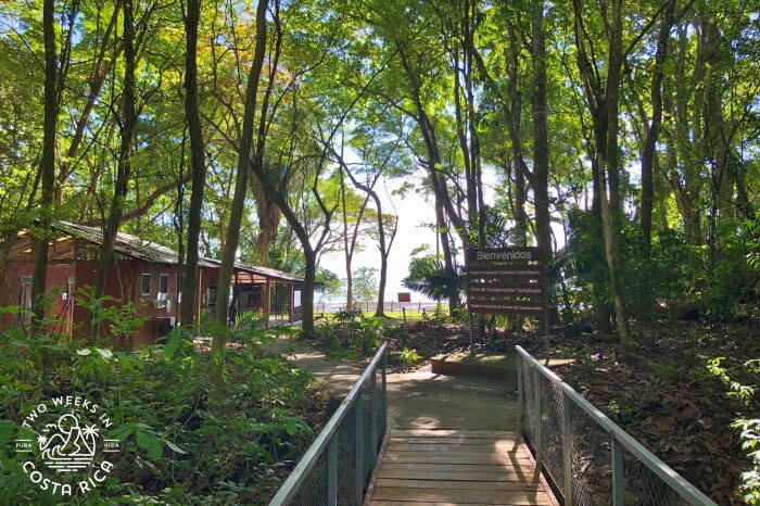
The Reserve has two trails. The main trail, Sueco Trail, leads to the beach. There is also a short trail called Danes Trail.
Danes Trail
If you’re looking for a short hike, the Danes Trail offers a nice loop. This trail is off the Sueco Trail, not far from the ranger station. It is 2 km (1.2 miles) so a good option if you want to experience the tropical forest without hiking for too long.
Sueco Trail
The Sueco Trail is the reason why most people visit Cabo Blanco Nature Reserve. But this hike shouldn’t be taken lightly. It is 5 km to get to the beach, and another 5 km back to the ranger station, totaling 10 km or 6.2 miles. For most people, it takes about 2 hours each way. Most recently, we did the hike with our preschooler and 1.5 year old in a baby carrier. It took us about 2.5 hours each way. It was not easy for our 5-year old, but he made it and he was still smiling at the end!
Tip: Be sure to arrive at the Reserve no later than around 11:00 a.m. if you want to do the trail to the beach. The park closes at 4:00 p.m. and you’ll need about five hours to do the hike and have some free time to relax and enjoy the beach.
Trail Conditions
The Sueco Trail passes through dense tropical forest. Overall, the trail is well maintained but very rustic.
From the ranger station, it starts fairly easy, with some steep parts. Often, the steep portions have rustic steps made from uneven concrete pavers, which make things a little easier.
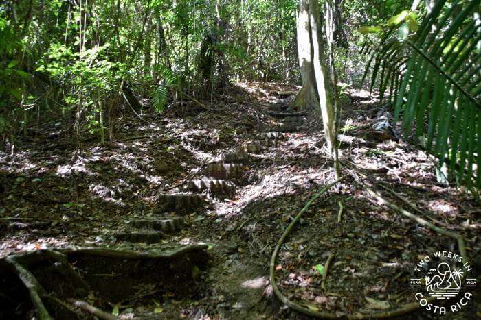
The middle 2 km or so (1.2 miles) is challenging at times. There are many portions where you’re hiking up a sharp incline for a few minutes. Sometimes it can be hard to get your footing due to the irregular terrain. Tree roots, rocks, and loose gravel are all obstacles along the way. We found using a walking stick to be helpful.
You’ll also have to cross a few shallow rivers. These have makeshift rock “bridges,” so you just have to keep on top of the rocks to not get wet. In dry season (December through end of April), these rivers don’t have much water flowing, but they can get bigger during rainy season.
The last 2 km (1.2 miles) is fairly easy with some steep sections. Especially as you get down to beach level.
What You’ll See
As you roll up and down the hilly terrain, you’ll see gigantic trees draped with vines, exotic flowers, strange seedpods, and lots of wildlife.
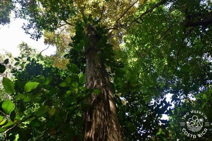
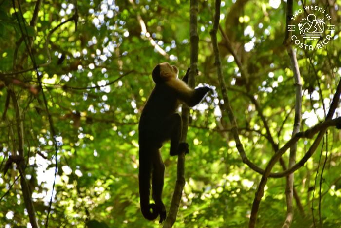
We have been to the park a couple of times. On each visit, we’ve heard howler monkeys grunting in the canopy and have seen a large family of coati (racoon-like animals) foraging on the forest floor. Most recently, as we neared the beach, we met a troop of white-faced monkeys. They were in the treetops, but we managed to get a close-up of some of them.
Even just driving along the small road to the ranger station, we have seen white-tailed deer hiding in the shrubs.
Other animals that can be spotted include anteaters, raccoons, and porcupines. We’ve also heard from more than one of our readers that they have seen a big cat, like a puma! We haven’t been so fortunate ourselves but can see how these elusive animals could be found in such a remote place.
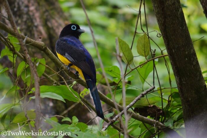
We have also seen many types of butterflies and birds. For birds, we have spotted trogons, wrens, and Brown Booby seabirds. Many seabirds nest on the tall island just off the coast, Isla Cabo Blanco.
The Beach
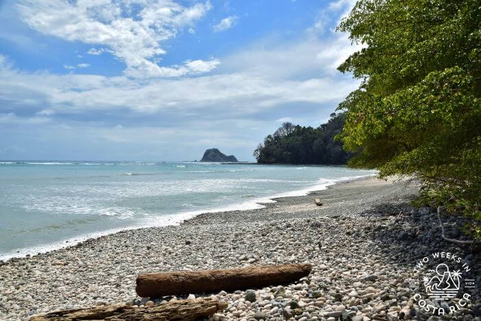
One of the best parts of the hike is arriving at the beautiful Playa Cabo Blanco.
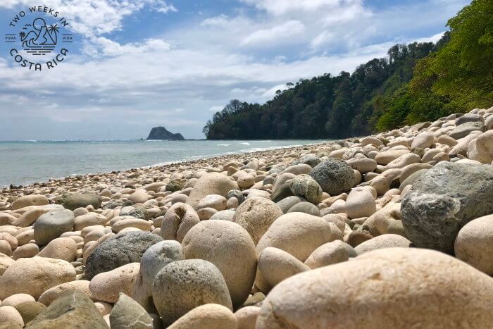
This beach can be reached only on foot (or by boat) so it really makes you feel like you have discovered something special. The sand is bright white. Much of it is covered with perfectly round, smooth white rocks. If you walk towards the right, you’ll find some sand to put down a towel.
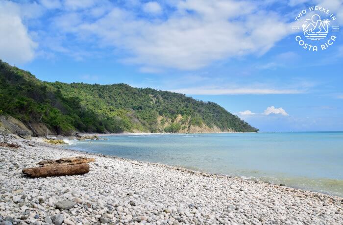
The water in the cove is a gorgeous turquoise color. While the waves aren’t usually too strong, it does drop off suddenly so it’s better for wading than swimming.
Planning Your Visit to Cabo Blanco Nature Reserve
Cost
Foreigners: $12 per person adults. $5 children ages 6-12. Free for children 5 and under.
Citizens and Residents: 1,600 colones adults. 500 colones children ages 6-12. Free for children 5 and under.
Park Hours
Wednesday through Sunday, 8:00 a.m. to 4:00 p.m.
The park is closed on Mondays and Tuesdays to limit the impact on wildlife.
Accessibility
This Reserve is not handicap accessible.
What to Bring
Be sure to wear closed-toe, good-gripping footwear. Hiking boots or sneakers are fine. The trail can get muddy during rainy season (May through November).
Also bring sunscreen, insect repellent, and binoculars if you are into birding.
Since it is a long hike and the park is very remote, pack a lunch or at least some snacks.
Bring plenty of water as you’ll be hiking for several hours in 80°+ F (27° C) degree heat.
Finally, don’t forget to wear your bathing suit under your clothes or bring it to change into. You’ll definitely want to enjoy a quick dip in the Pacific to cool off after reaching the beach. There is no changing room at the beach, but they do have some rustic showers to rinse off after.
For more tips on what to bring, check out our post on Packing Your Daypack.
Getting There
Public Bus from Montezuma
If you’re staying in Montezuma and won’t have a rental car, it’s easy to take the public bus. You just need to plan so that you have enough time for your hike back.
Buses leave Montezuma for Cabuya around 8:15 a.m. and 10:15 a.m. They return at 11:20 a.m. and 3:20 p.m. *Double check the schedule when you’re in Costa Rica for the most up-to-date information. The ride is around 40 minutes.
The bus will drop you off at the turnaround before the park entrance. Then, you’ll have a short walk to the ranger station (5-10 minutes).
Driving Directions
If you have a rental car, you can drive right to the ranger station, which is located just south of the town of Cabuya. There is a small parking area near the ranger building.
From Montezuma
The drive from Montezuma is about 25 minutes, depending on road conditions. Take the dirt road south out of town. Follow it along the coast until you reach the small town of Cabuya. In Cabuya, keep left on the main road, following signs for Reserva Natural Absoluta Cabo Blanco.
Be sure to keep a lookout for the giant strangler fig tree on the right-hand side as you approach Cabuya. It is said to be one of the largest trees in Costa Rica!
From Santa Teresa
Main/Easiest Route
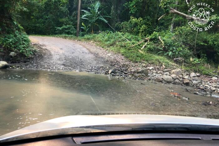
There are a few different roads you can take from Santa Teresa. Many are back roads, which are rough dirt. Some have river crossings. So be sure to plan your route in advance.
Note: Cell phone coverage is very spotty once you get out of the main towns so be sure to download maps offline or use GPS.
The easiest way from Santa Teresa is to go back to Cobano, then take the main road to Montezuma (Route 624). Turn right when you reach the end of Route 624 in Montezuma and continue south along the coast until you get to Cabuya. In Cabuya, keep left on the main road, following signs for Reserva Natural Absoluta Cabo Blanco. Drive time is about one hour.
Adventurous Route During Dry Season
In the dry season when there has been little rain (approx. January to April), you can go a more direct way via Mal Pais. You’ll need a solid SUV and 4×4 for this. But it ends up being faster than going the long way up to Cobano.
In Mal Pais, take a left off the main road shortly after La Esquinita Coffee and Deli. This rough dirt road cuts directly across the peninsula to Cabuya. It’s slow going and there are some steep stretches as well as several river crossings. Water levels are usually not too deep in dry season, though. If you aren’t sure, always get out of your car to check first or wait for another car to cross before you.
Here is a map showing this route option.
Conclusion
Our visits to Cabo Blanco Nature Reserve have always reminded us of why we love hiking in Costa Rica. Not only is the scenery gorgeous, but it offers the ideal amount of physical activity and wildlife viewing. To top it all off, you get to cool off in the Pacific Ocean and enjoy the beach. It’s the perfect balance.
Have a question about visiting Cabo Blanco Nature Reserve or have you been yourself? Let us know in the comments below.
Looking for more information to plan your trip to the Nicoya Peninsula? Check out these posts:
Montezuma: A Bohemian Beach Town – Montezuma is an eclectic beach town with a cute main area along the sand. Read our detailed guide for more info.
Mal Pais Tide Pools and Natural Hot Tubs: If you’re visiting Santa Teresa/Mal Pais, these swimmable tide pools are a must-visit. They would also make a fun day trip from Montezuma.
Taking the Puntarenas-Paquera Ferry: The ferry is a great way to access the southern Nicoya Peninsula. It breaks up the drive and offers some fantastic views of the Gulf of Nicoya.
