If you’re headed to the Lake Arenal area and want to do an off-the-beaten path hike, El Jilguero Ecotourism Project may be the perfect fit. This little-known ecotourism project is in the mountains on the backside of Tenorio Volcano. On a visit, you can walk the rustic trail to see rainforest, cloud forest, and even volcanic fumaroles (steam vents). In this post, we’ll tell you about trail conditions, what you’ll see, and how to arrange a visit.
Location
El Jilguero Proyecto Ecoturistico (El Jilguero Ecotourism Project) is located near the small town of Tierras Morenas. The closest major, though still small, towns are Nuevo Arenal and Tilaran, each about 45 minutes away. Our family was staying in Nuevo Arenal when we visited.
Though not far off the main road around Lake Arenal, El Jilguero is up in the mountains. Access is via a steep dirt road that is rough in places (4×4 required). See below for directions and driving conditions.
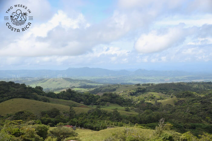
Although the drive is rough, it is well worth it. From the top on a clear day, you can see all of the Cordillera de Tilaran mountain range, Rincon de la Vieja Volcano, Miravalles Volcano, Tenorio Volcano, and Arenal Volcano.
Background
The name for the project, El Jilguero, comes from a local bird, in English called the Black-faced solitaire.
This gray and black bird is in the thrush family and has a distinct orange beak and legs. It prefers dense, wet mountain forest, the kind of environment you find at the project.
El Jilguero Ecotourism Project was started in 2021. The land where the project is located is actually part of Tenorio Volcano National Park, but on the other side of the volcano.
Tenorio Volcano National Park is well known for the Rio Celeste, a gorgeous river and waterfall with bright blue water. The Rio Celeste side of the park is best accessed from the town of Bijagua. For more information about visiting that area of the park, read our post, the Enchanting Rio Celeste.
The Jilguero project was created when the Costa Rican government purchased private land (about 200 hectares/494 acres) to add to Tenorio Volcano National Park.
Today, the project encompasses 1.8 hectares (4.5 acres) of primary and secondary forest. We would be exploring just a small fraction of this on our day hike.
Starting the Tour
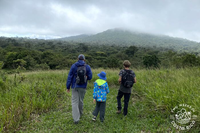
After we made it to the top of the mountain, we parked outside a simple building and met Mauricio, who would be our guide for the morning. He was a young local from the area and part of one of the 18 families who worked on the project.
With the cool breeze blowing, he explained a little about the project then led us to the trail.
The Trail
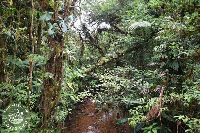
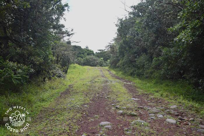
As we descended the hill, the forest quickly became dense and wet. Mauricio explained that the surrounding forest was a mix of cloud forest, due to the altitude, and tropical rainforest.
Sendero El Jilguero (El Jilguero Trail) was rustic but beautiful.
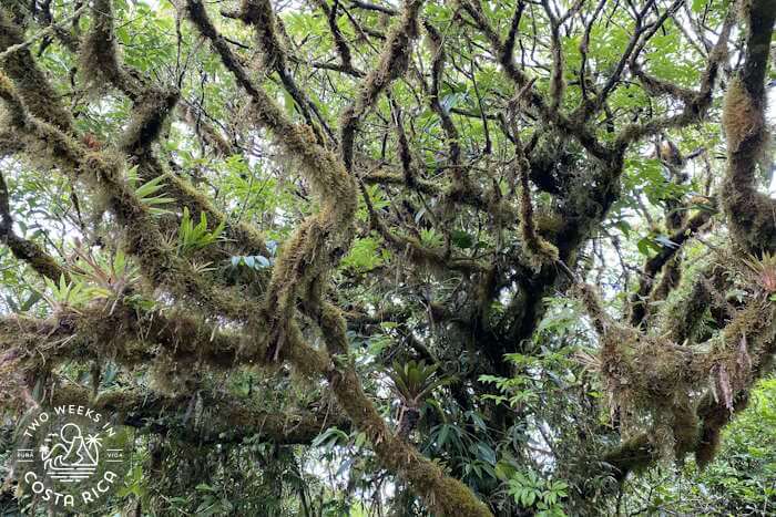
Along the two kilometer (1.2 mile) path, we saw giant trees covered in thick moss, bromeliads, and crystal-clear streams. The streams and rivers that run through the property were slightly acidic because of volcanic minerals. We learned that some locals swim in these natural pools.
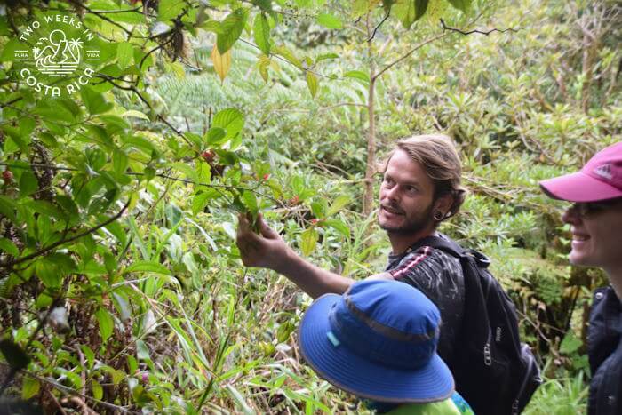
We also came across lots of interesting plants and flowers. One medicinal plant, caña agria, was used to make a drink that is good for the kidneys.
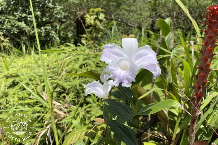
Some flowers called flor de un dia stood out in the grassy areas of the property. These white, purple, or lavender orchids bloom for only one day, hence the name “one day flower.”
Mauricio was very knowledgeable about everything we saw, passionate about the environment, and taught us a lot.
Wildlife
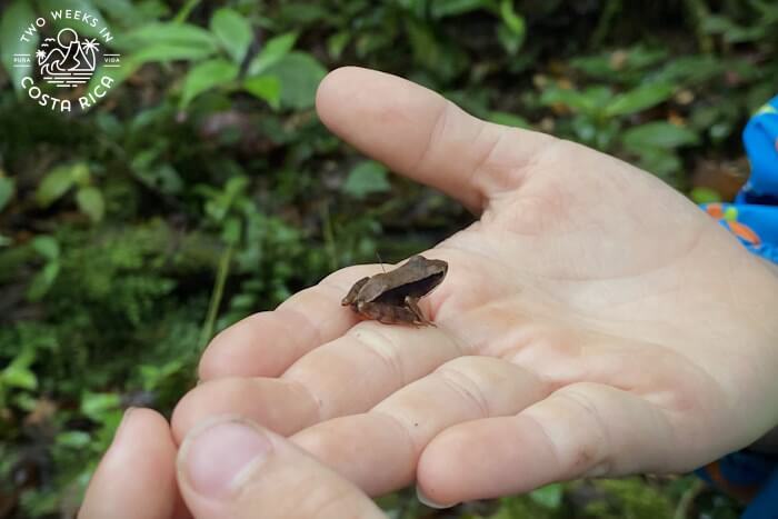
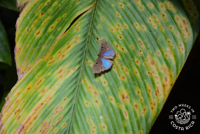
For wildlife, Sam, our son, spotted a tiny brown frog in the leaf litter. We also saw some butterflies and interesting insects.
Fumaroles/Hornillas
After spending an hour or so walking through the forest, we headed back to the car to access the other side of the trail.
If we had kept walking, we would have eventually connected to the fumaroles area, but the hike was a little hard for our youngest son (age 4 at the time). Mauricio thought it would be better to drive to the other trailhead right off the road so we could reach the bubbling river faster.
From the road, the grassy trail down to the river was very steep but in good condition. The clouds from the morning had given way to sun and we all had to take off our jackets. High up on the mountain, the weather seemed to shift quickly.
We soon entered the forest once again and came to a small opening in the ground. This had charcoal-colored mud and was steaming a little. With a stick, Mauricio moved the mud and leaves covering the hole to reveal bubbling water erupting from the ground. The heat from Tenorio Volcano caused steam vents like this when it released hot gas and vapor out of the ground.
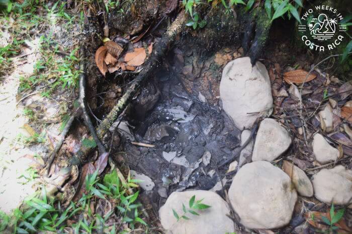
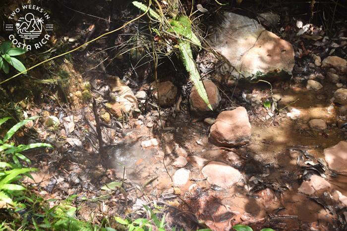
Continuing on the path, we came to the main point of interest: the fumarole river.
This was a section of the river with about 10 steam vents. The hot air made the mud and water bubble constantly. We were able to view it safely from behind a fence and got lots of pictures and videos. It was crazy to think that the volcano’s energy was this powerful.
Birds
On the way back to the car, Mauricio heard some strange bird sounds on a side trail.
Sure enough, there was a flock of Orange-collared Manakins hopping around in the trees. These small orange and black birds make a snapping sound with their wings. They are shy and somewhat hard to find so it was a real treat to see them, even if only from a distance.
We then hiked back up the hill, Jenn carrying our youngest son in her arms, thanked Mauricio for a great morning, and went back to our hotel.
Visiting El Jilguero Ecotourism Project
Booking a Tour
This is a newer project so everything is very informal. Tours can be arranged from 7:00 a.m. to 3:00 p.m.
We contacted them through WhatsApp, which is how we would recommend setting up a tour. Their WhatsApp is +506 8717-3965
You can find more information about the project on their Facebook page.
Cost
5,000 colones per person (about $10 USD)
What to Bring/Wear
The climate is a little cooler compared to the lake area and changes quickly at El Jilguero. We recommend lightweight long pants, a T-shirt, and light raincoat. For footwear, the trail is steep, uneven in places, and often muddy. Hiking boots or sturdy sneakers are best.
Also bring some repellent, sunscreen, snacks, and plenty of water as there are no amenities nearby.
Road Conditions and Directions
El Jilguero Ecotourism Project is off Route 142, the road that goes around Lake Arenal.
From Nuevo Arenal, go west on Route 142. After Piedras, take a right onto Route 927. You’ll take this side road for a few minutes. The road is paved.
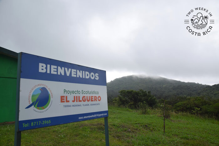
Near the town of Tierras Morenas, take a right, then a left to get on the dirt road to the project. There is a sign.
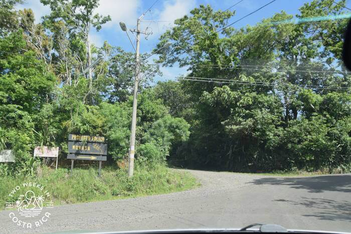
The building where the tour starts is 4 km (2.5 miles) or about 20 minutes from this point.
The last dirt road you take is bumpy and steep. We highly recommend a four-wheel drive vehicle with good clearance. This road is not used a lot and was much like a trail at the time of our visit.
Here is a link to Google Maps with the exact location. Make sure to load the map before you leave because cell service is bad at the project.
Conclusion
El Jilguero Ecotourism Project is a beautiful property with lots to discover. You could easily spend several hours, checking out the dense forest and interesting plants and volcanic features. If you’re looking for an off-the-beaten path hike near Lake Arenal, it’s well worth a trip.
Have a question about visiting El Jilguero Ecotourism Project? Ask us below.
Looking for more information to plan your trip to Costa Rica? Check out these posts:
Mirador El Silencio: For an off-the-beaten path hike around the popular Arenal Volcano, Mirador El Silencio is a less crowded option.
Madre Verde Nature Reserve in Palmares: If you’re in the San Ramon area, this private reserve was created to reforest former farmland. You can walk its well-maintained trails to see thick tropical dry forest and some scenic viewpoints.
Rainmaker Conservation Project: Rainmaker is another private reserve in the countryside near Manuel Antonio with a rustic trail through dense jungle, hanging bridges, and waterfalls.
